In collaboration with NVIDIA and Aerometrex, Cesium has released the Omniverse AECO demo pack. Designed to be an easy way to get started leveraging 3D geospatial data for architecture, engineering, construction and operation (AECO) workflows, the demo pack allows you to experiment integrating an architectural design model within an accurate geospatial context.
Continue reading for an overview on how we created the AECO demo pack and information on its key features.
The first step in creation of the AECO demo pack was to establish consistent georeferencing for our site. A latitude and longitude for the center of our site was chosen to correspond with the origin coordinates (0,0,0) in both our Omniverse stage, and our digital content creation (DCC) tools such as Rhino and Grasshopper. Using consistent coordinates across the toolchain results in efficient and accurate data workflows throughout the lifecycle of the project.
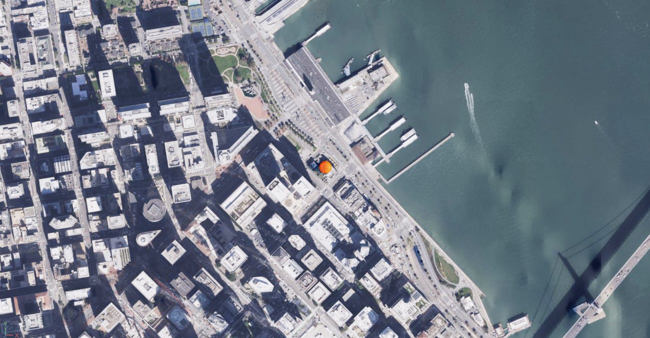
The project site is located at 37.79379, -122.39324, in San Francisco, CA.
Aerometrex provided high fidelity 3D Tiles of San Francisco to be used for the surrounding context of our proposed design. This 2cm resolution photogrammetry dataset was constructed from helicopter-captured photographs using proprietary capture patterns and techniques to photograph the urban environment for re-constructing as 3D mesh, transformed into 3D Tiles and streamed into the project with Cesium for Omniverse.
To support insertion of the proposed design, a project boundary was defined using precise latitude and longitude coordinates. This boundary was used to clip the 3D Tiles data offline, removing the existing conditions so that the proposed design can replace it.
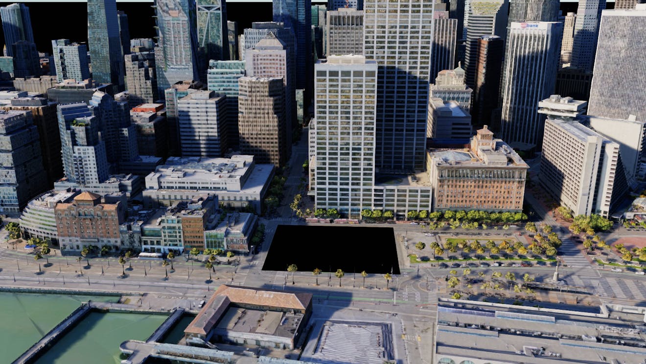
Aerometrex 2cm photogrammetry 3D Tiles with the project site removed.
The existing conditions data was placed into a separate 3D Tiles dataset so that it can be utilized for comparisons between existing and proposed scenarios.
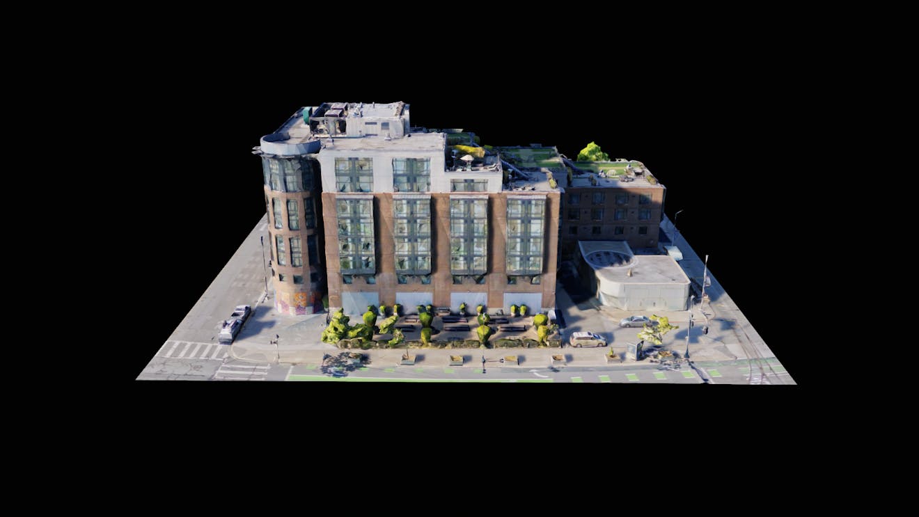
Aerometrex 3D Tiles of the existing conditions clipped to the project boundary.
Finally, Cesium World Terrain was added as a supporting layer. To prevent clashing with the photogrammetry, it was lowered by 1.5m. As the Cesium World Terrain was only being used to provide background content in imagery and video, the impact on the positional accuracy of this layer by manually moving it was deemed acceptable.
Cesium World Terrain as a supporting layer to the Aerometrex Photogrammetry.
A mesh of the existing conditions was generated for editing in a digital content creation (DCC) package. It was manually edited and integrated with the new proposed site design, including re-alignment of kerbs, surfaces and other site changes. It was then exported as a USD and added to the stage as a USD Payload. Asset libraries within USD composer were used to add props such as vegetation and furniture to the proposed site.
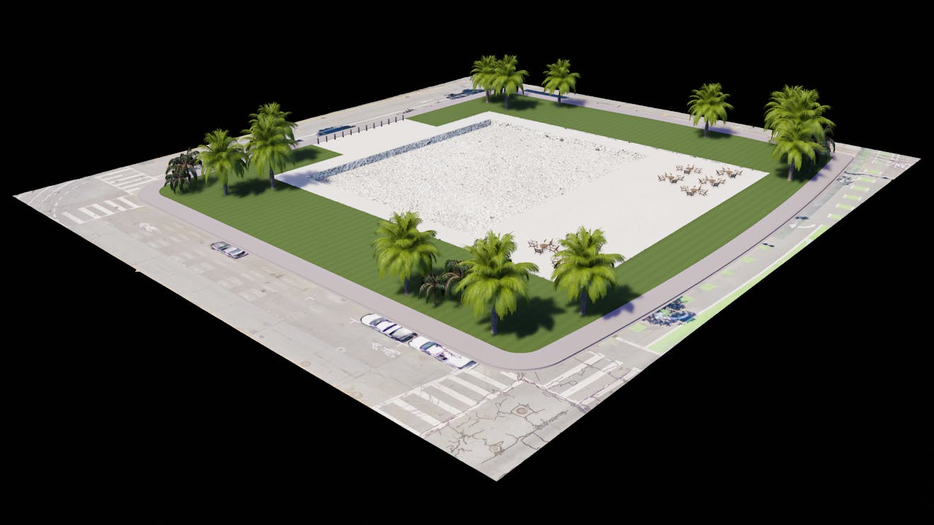
2cm photogrammetry mesh integrated with the proposed site layout, with vegetation and furniture added.
The base building design was authored in McNeel Rhino and the facade design was authored in Grasshopper. Each was exported as separate USDs using the Omniverse Rhino Connector, and added to the stage as USD Payloads.
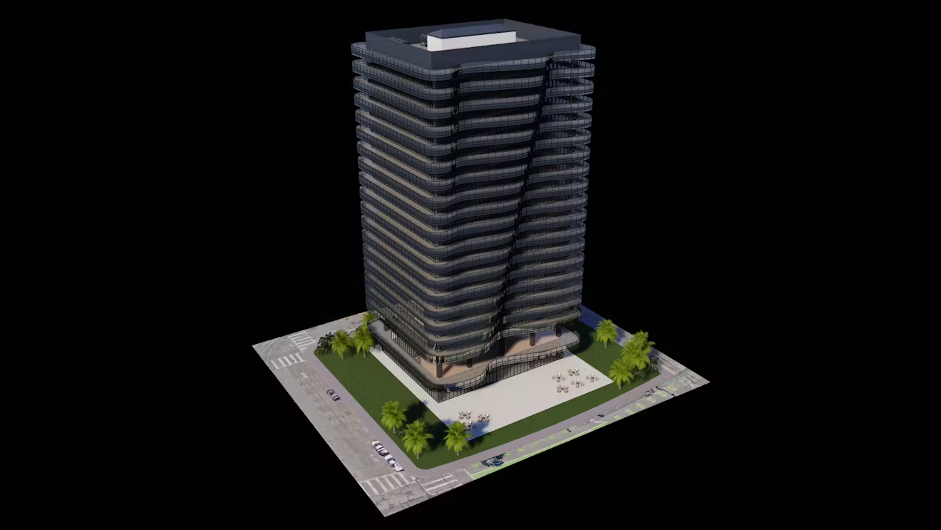
Proposed building design from Rhino and Grasshopper located on the proposed site.
For further information on working with AECO DCC tools and Cesium for Omniverse, see the following tutorials.
USD Variants were used to facilitate simple switching between existing conditions and multiple design options by changing a single property. This is particularly useful when dealing with complex design scenarios consisting of multiple USD’s and other data sources that may need to have visibility toggled individually when switching between scenarios.
A USD Scope named DesignVariants was added to contain the variant set information and acts as the parent prim for all existing and design data. A child prim was created for each of the existing and design scenarios. These contained all subsequent child prims relevant to the corresponding design, including USD Payloads and 3D Tiles. Using the Variant Editor in USD Composer, a variant was created for each of the existing and design scenarios, ensuring the relevant prim is only visible when the corresponding variant is active.
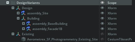
Stage hierarchy for USD Variants and the prims containing existing and design scenarios.
Once configured, the Variant Presenter in USD Composer can be used to easily switch between existing and design scenarios with a simple dropdown menu. Additional design scenarios can be added as new variants as required. Variants could also be used for other design factors, such as different material treatments or minor changes to the facade design.
Switching between variants using the USD Composers Variant Presenter tool.
Proposed developments in the built environment often need to comply with overshadowing planning regulations. The Sun Study tool along with accurate geospatial data streamed by Cesium for Omniverse creates a powerful tool for assessing shadow impacts.
The environment prim was configured with the correct latitude and longitude for the project location, obtained from the CesiumGeoreference. North Orientation was set to 90 degrees, which aligns with the orientation of data streamed from Cesium for Omniverse. This ensures the sun rises in the east and sets in the west.
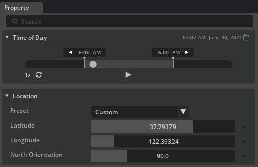
Accurate latitude and longitude representing our project site in the environment prim.
The Sun Study tool can then be used to capture images or video at specific times and dates, based on the project requirements. A camera placed above the project, with a large focal length makes repeat captures from the same location simple.
For more information see Dynamic Skies and Sun Study.