
3D TILES IN X3D
Anita Havele, Executive Director, Web3D Consortium
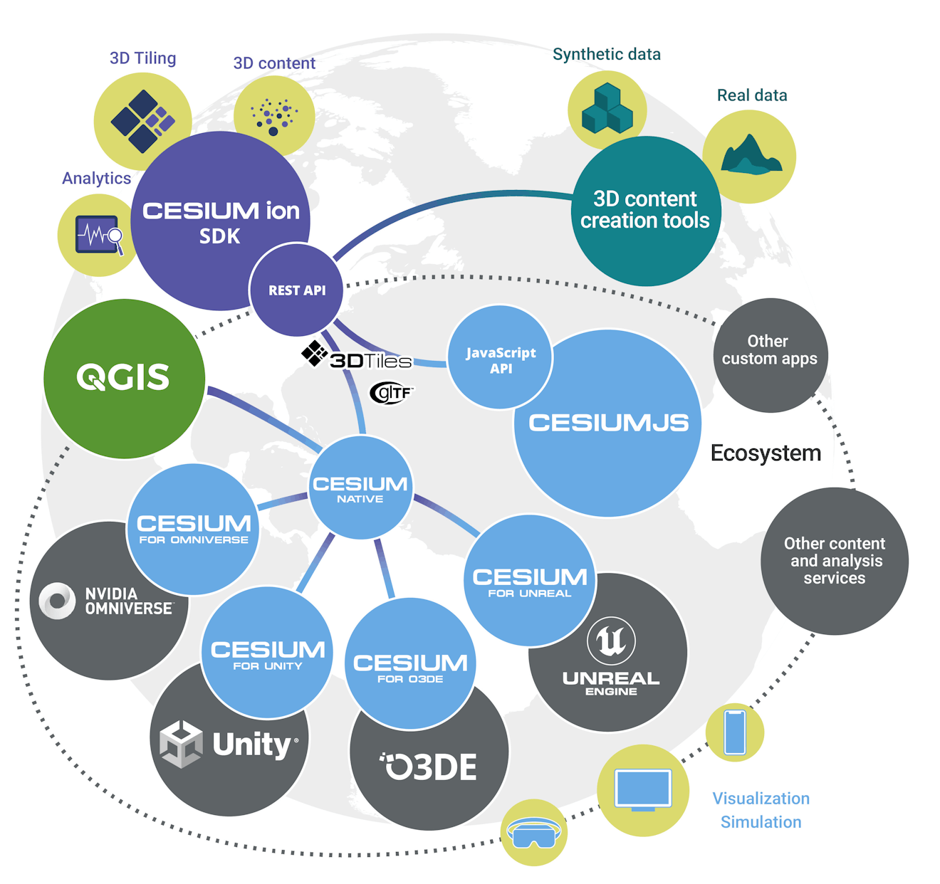
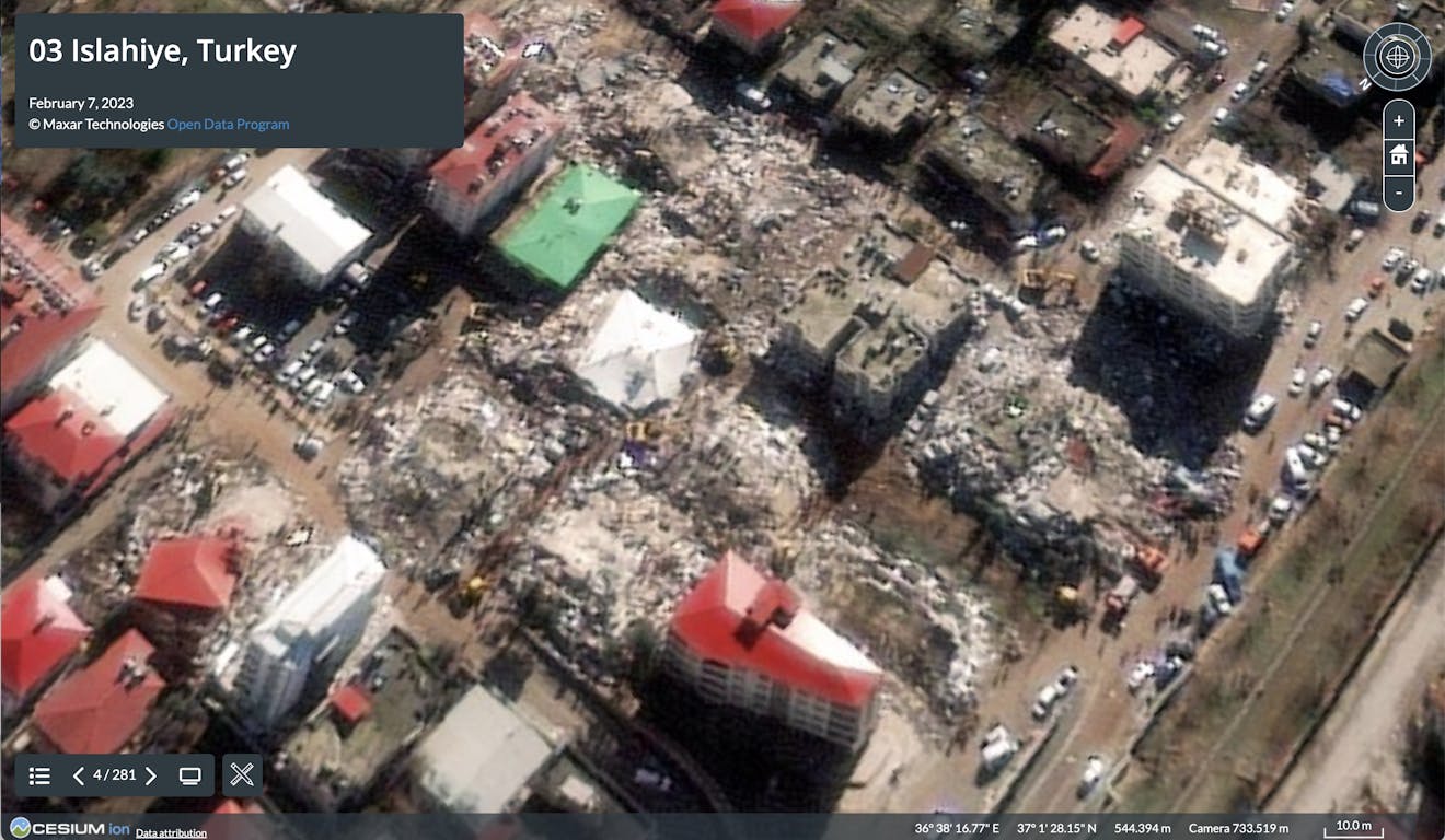
This project expands the 3D Tiles ecosystem by creating a pipeline to stream massive 3D geospatial datasets using X3DOM, an X3D-based browser for visualization of interactive 3D on the Web. The end result will provide an efficient way to store and transmit 3D data in a tiled format using X3DOM, allowing for the visualization of large-scale 3D scenes in real time. This work will bring synergy and interoperability to two popular—but disconnected—international open geospatial standards: X3D and 3D Tiles. The project will be managed by the Web3D Consortium in partnership with its members, EarthStruct, Virginia Tech, MBARI, and Versar.