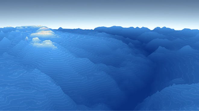
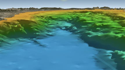
With Cesium ion, combine your 3D data with Cesium's global 3D base layers and stream it to apps. With CesiumJS, build web-based visualizations for underground and underwater, such as this terrain for Mariana Trench.
Cesium's roots are in aerospace, but we know that 3D geospatial visualization and simulation are just as impactful below the Earth's surface and under its oceans. Jumpstart the creation of coastal and ocean visualizations with Cesium World Bathymetry, our global bathymetry and topographic terrain, and use the Cesium platform to tile and position your own bathymetric data precisely on the globe. Using the visualization capabilities and analytics of CesiumJS, build apps that explore and analyze subsurface spaces like tunnels and mines and the assets they contain, real-time IoT data for oil pipelines and other infrastructure, and subsurface geological data and terrain.
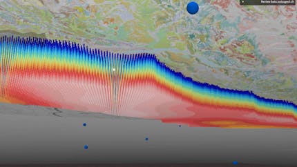
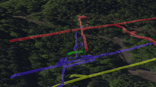
On behalf of Switzerland's Federal Office of Topography, Camptocamp added a 3D viewer for geological data to the interactive 3D map of the entire country. The viewer uses Cesium to visualize underground and brings together numerous datasets, including boreholes, seismic data, and bedrock maps.
Cesium and our collaborators at Kaarta were one of five teams selected to participate in the 2020 Dense Urban Online Challenge in-person hackathon. This was a DoD program exploring solutions to help first responders and military operators working in cities with high density and complex underground structures.
In Terradepth's AO platform built on CesiumJS, users can see everything from the natural seabed to sunken wrecks.
With Cesium ion, combine your 3D data with Cesium's global 3D base layers and stream it to apps. With CesiumJS, build web-based visualizations for underground and underwater, such as this terrain for Mariana Trench.
CesiumJS users can zoom into the ground, and the zooming, rotating, and panning behaviors are appropriately adjusted underground. The appearance of the underside of the globe is adjusted to help users understand what they are seeing.
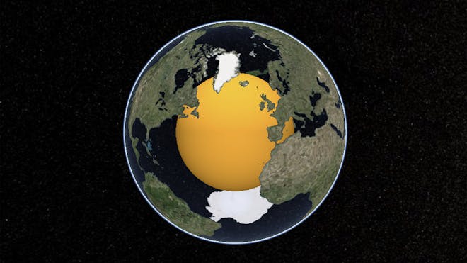
Make the earth or water transparent to reveal 3D data you've positioned beneath the surface, and tune the appearance of underground scenes. Control which parts of Earth's surface are transparent to make it easier for users to understand the location and size of the subsurface data. This visualization of the Earth's core is more comprehensible with transparent oceans and visible landmasses.