osgEarth Adds Support for Cesium Native
This is a guest post by Jason Beverage of Pelican Mapping. Pelican Mapping maintains the open source osgEarth, the leading geospatial SDK built on top of OpenSceneGraph. Jason is a longtime Cesium user and contributor, and Pelican Mapping was awarded an Ecosystem Grant in summer 2023.
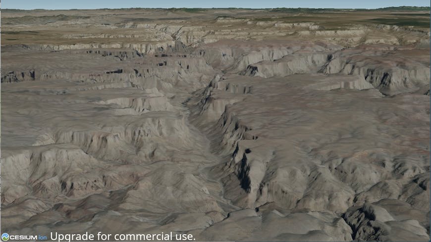
The Grand Canyon: osgEarth rendering Cesium World Terrain with a Bing raster overlay using Cesium Native. Courtesy Pelican Mapping.
Pelican Mapping is proud to announce that we have added support for Cesium Native to osgEarth as part of the Cesium Ecosystem Grants Program!
osgEarth has supported loading 3D Tiles datasets since 2020, based on a completely custom implementation of both a glTF plugin and a 3D Tiles layer plugin. The ability to visualize 3D Tiles in osgEarth has opened the door to a whole new class of data types, and being able to render high-resolution photogrammetry models and other assets from Cesium ion has been a game changer.
The 3D Tiles ecosystem has grown at a rapid pace and is quite challenging to keep up with for our custom implementation. We began to find datasets that didn't load properly in osgEarth, and we didn’t have the bandwidth to support extensions that were useful but required lots of work.
After seeing the success of Cesium for Unreal, we applied for a Cesium Ecosystem Grant to add support for Cesium Native to osgEarth rather than rely on our homegrown solution—ensuring that we have the same best-in-class 3D Tiles support as Cesium for Unreal in osgEarth. We are proud to have been awarded the grant to complete this work.
Pelican Mapping received a Cesium Ecosystem Grant to integrate Cesium Native into osgEarth. Courtesy Pelican Mapping.
Inspired by projects like Cesium for Unreal, Cesium for Omniverse, and vsgCS, we designed a new osgEarth NodeKit called osgEarthCesium that exposes Cesium Native to osgEarth.
Bringing the entire Cesium World Terrain draped with Bing imagery from Cesium ion is as simple as adding this to your earth file:
<CesiumNative3DTiles name="Cesium World Terrain">
	<asset_id>1</asset_id>
	<raster_overlay>2</raster_overlay>
</CesiumNative3DTiles>
osgEarth can use Cesium Native to load datasets from Cesium ion or any stand-alone 3D Tiles dataset, including Google Maps Platform’s Photorealistic 3D Tiles.
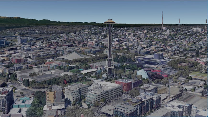
osgEarth rendering the Space Needle in Seattle, Washington, USA, from Photorealistic 3D Tiles using Cesium Native. Courtesy Pelican Mapping.
You can view instructions on how to build osgEarth with support for Cesium Native here. We're excited to see what you build with osgEarth and Cesium Native!