osgEarth Adds Support for Cesium ion
This is a guest post by Jason Beverage of Pelican Mapping. Jason is a long-time Cesium user and contributor; the particle system and imagery slider are among his contributions. The post is about osgEarth’s added support for Cesium ion. Get in touch if there are other places you would like to see Cesium ion supported. - Sarah
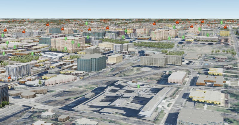
osgEarth rendering Cesium ion Washington DC 3 inch imagery fused with ArcGIS base imagery, ReadyMap Elevation, and OpenStreetMap MapnikVectorTile features.
Pelican Mapping has added support for Cesium ion to their osgEarth globe rendering toolkit!
osgEarth is an extension to the OpenSceneGraph scene graph library that brings the power of modern geospatial technology to OpenSceneGraph based applications. osgEarth powers everything from basic GIS applications to high performance flight simulators and nationwide weather and traffic television broadcasts.
osgEarth supports a wide array of data sources, and now osgEarth users can access imagery layers in their Cesium ion account using the new cesiumion driver.
The simplest way to get started with Cesium ion in osgEarth is to create an Earth file that references your Cesium ion asset id and provide your API token. It’s as simple as this:
'''js
<image name="cesiumion" driver="cesiumion">
    <asset_id>YOUR_ASSET_ID</asset_id>
    <token>YOUR_API_TOKEN</token>
</image>
You can view your Earth file using osgearth_viewer or any other osgEarth based application
osgearth_viewer cesiumion.earth
Although osgEarth currently only supports imagery layers from Cesium ion, we hope to add support for more formats such as terrain and 3D tiles in the future!