Planet Satellite Imagery in Cesium
The Cesium team has been working with Planet to bring their imagery to the Cesium community. Planet images the entire Earth every day using their own satellites, developed in-house. With this imagery, they’ve built color-balanced, cloud-free whole earth base maps that range from seamless mosaics to automated mosaics produced at frequent intervals. Their time-sliced mosaics allow users to know exactly when each image was captured.
They’ve also created the Open California product, an openly licensed preview dataset of a California imagery archive with imagery as recent as two weeks after acquisition.
Cesium is integrating with Planet’s API to consume Planet’s imagery products, temporally. You can see a preview of this integration at GEOINT 2017. Get in touch and let us know your use case for time-dynamic satellite imagery.
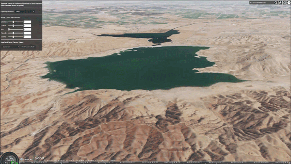
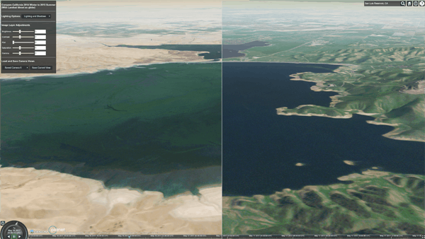
An animation of a timeline demo we created with Planet's data. This shows a timelapse of the four seasons from Fall 2014 to Summer 2015 at San Luis Reservoir. Note the receding waterline showing the effects of California's most recent drought.
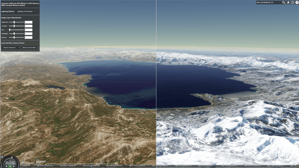
A slider bar in this demo allowed users to compare water levels in Winter 2014 and Summer 2015.
Planet's extensive archive of satellite imagery is well matched to Cesium's support for temporal data.
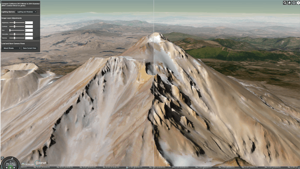
Users can adjust the timeline to see imagery at different times. These images of Mount Shasta were taken in 2013 and 2014. Note the clear shadows.