Royal Air Force Plans Operations in XR with Cesium for Unreal
The UK’s Royal Air Force (RAF) has been preparing troops for some missions with immersive XR simulations in Cesium for Unreal.
RAF collaborated with VRAI to build its Virtual All-Domain Environment (VADE) mission planning and rehearsal system for both aircrews and operators on the ground. Defense planners can view operating areas, such as patrol routes, in typical light and with predictive weather conditions, providing critical situational awareness prior to deployment.
.PNG?auto=compress%2Cformat&w=870)
Kabul, Afghanistan, in RAF’s VADE, built on Cesium for Unreal. Courtesy UK Royal Air Force.
VADE began as a demo in 2021 and is still considered a proof of concept, but it was quickly applied to operational training—accurate, shareable 3D geospatial context enables better decisions. Users have been able to rehearse parachute assaults, visualize adversary equipment, and inspect potential evacuation routes at a 1:1 scale in XR, gaining a deeper understanding of locations and capabilities. VADE has been used in planning recent evacuations.
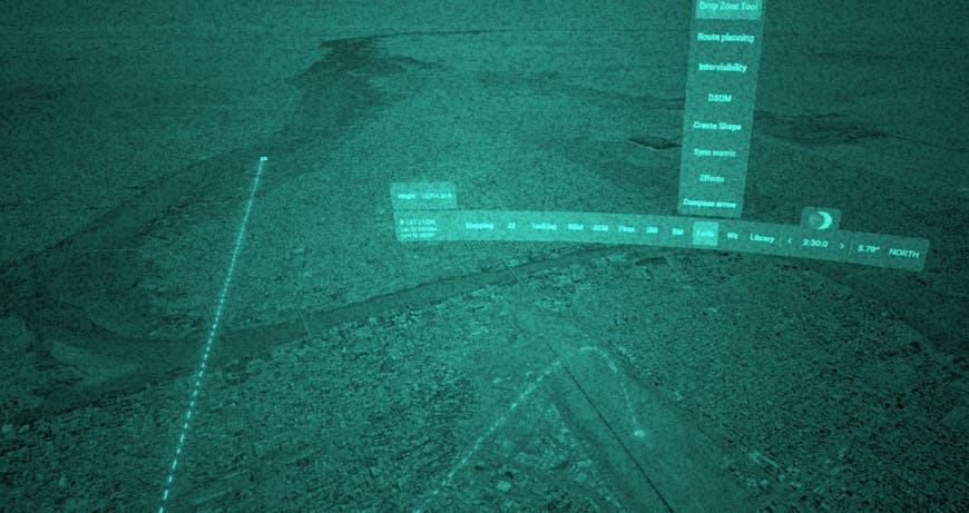
Through a suite of tools, users can rehearse parachute drops in VR in VADE, simulating the view they can expect to see through night vision goggles at their desired altitude. Courtesy UK Royal Air Force.
“How can I surmise this: through the darkness I was not met with the usual confusion of a compound I had imagined from above, but instead could instantly recognise the situation and orientate myself within milliseconds. One could argue this, on occasion, is the difference between success and failure,” said one VADE user.
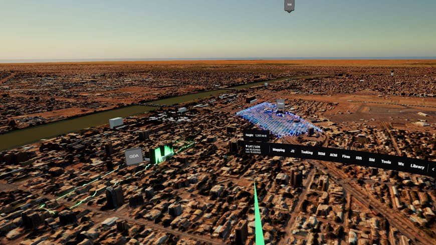
Maxar Technologies Precision3D 3D Surface Model is visualized within VADE. The ability to ingest this kind of data enables users to immerse themselves fully in any location around the world. Courtesy UK Royal Air Force.
Cesium ion enables VADE to be data agnostic, as the system can ingest various large datasets and render them in high fidelity quickly and accurately. Data from several sources comes together in VADE via Cesium for Unreal: Cesium World Terrain; Maxar Precision3D 3D Surface Model; imagery from Sentinel-2, Bing Maps Aerial, and the UK Ministry of Defence; Reveal Farsight models; photogrammetry from VRAI; and data from OpenStreetMap are hosted on Cesium ion On-Premises and tiled into 3D Tiles for streaming into Unreal Engine. With Cesium ion On-Prem, data is hosted offline and locally, ensuring security for RAF.
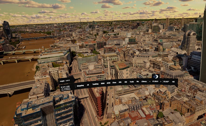
Defense planners can view operating areas in typical light and with predictive weather conditions. Pictured is London. Courtesy UK Royal Air Force.
To bolster situational awareness and modernize military planning and education, RAF uses Cesium to bring together better data, which can enable better decisions. Bring 3D geospatial to your mission-critical apps.