Cesium Supporting State-Sized Digital Twins
Australia is leading the world in investing in large scale digital twins. They got started early: in 2014 the Terria team built a National Map using TerriaJS with Cesium to visualize geospatial data from all levels of government. In the years since, Terria has developed digital twins for three of Australia’s six states: Victoria, New South Wales, and Queensland. That’s 78% of the total population of the country supported by a digital twin built on Cesium.
The NSW Digital Twin.
“Creating these digital twins has brought about a digital transformation for state agencies as they have been able to share, manipulate, and manage their data. The visualization component is critical because it brings the data to life. Our stakeholders recognise Cesium as a fundamental enabling technology for an open digital twin ecosystem."
- Marie Truelove, Product Manager
Terria Digital Twins
Digital Twins
These digital twins are virtual representations of the real world that serve the government, private companies, and the public with data on the natural and built environment. Not only do these digital twins contain vast amounts of geospatial data, but they are updated in real time with live information from an array of sensors, and they use AI, simulation, and machine learning to support decision making.
That’s a lot of data to track. Terria has helped state governments set up the infrastructure to manage—and visualize—that data so it becomes much more usable.
With a digital globe built on Cesium, users can zero in on the data that’s relevant to a particular area. And with the streaming efficiency of 3D Tiles through Cesium ion, they can stream whatever they need, right in the browser.
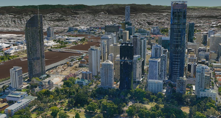
Users can layer numerous datasets for visualization and analysis, like this photogrammetry layer from Aerometrex.
A Single Portal
One of the greatest strengths of these state digital twins is bringing so many disparate—and previously inaccessible—datasets together into a single platform. Whereas traditionally parcel information, flood simulations, building proposals, and traffic monitoring may have all been siloed in different agencies, the digital twin brings it all together, allowing people to make faster, more informed decisions while reviewing the impact on multiple dimensions.
Bringing all these datasets into the same place, even sensitive datasets secured by access control, creates a collaborative digital workspace where all organizations work from the same authoritative datasets. This collaboration is essential to building resilient communities. For example, as telecommunications companies share their datasets with emergency agencies, the two are able to cooperatively analyze past wildfires, predict future hazards, and protect critical infrastructure.
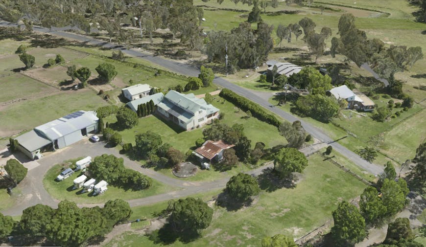
These digital twins cover entire states, including urban and rural areas, offering the ability to coordinate on many levels.
Real Time
Terria’s digital twins are living models, updated in real time with data from across the state to reflect current conditions. The digital twins provide real-time updates on wind farm production levels, pest activity, air quality, and live transport data. Because Cesium runs in the browser, users can access updates instantly.
Like the models, the digital twins themselves will continue to grow with ongoing investments from the government and the many stakeholders with data to share, evolving over time to meet future needs.
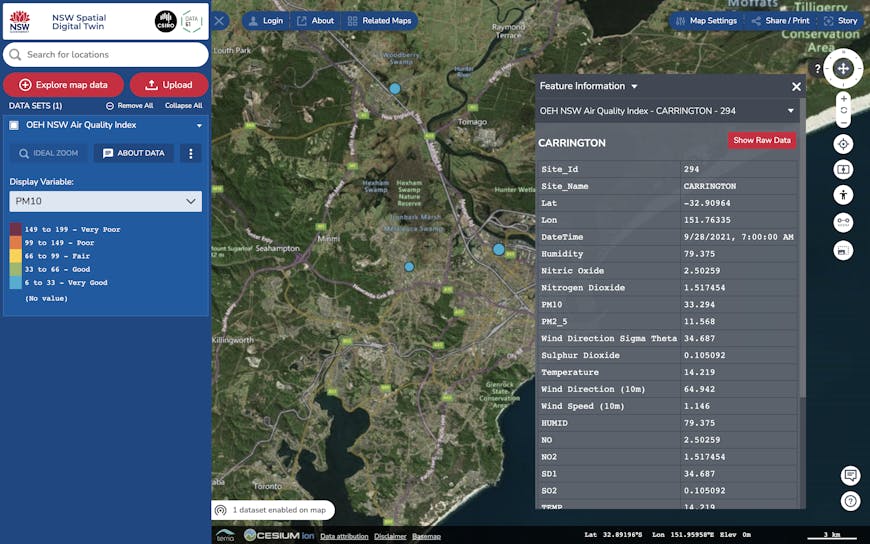
A workbench allows users to select relevant datasets to view, whether government land use data, 3D photogrammetry models, infrastructure details, or live updates like this air quality index dataset.
Simulations
A digital twin not only allows users to see current conditions, but enables them to run simulations to make more data-driven decisions in transport, infrastructure, and land management.
For example, with Cesium 3D terrain it’s possible to review historic flood data and evaluate the potential impact of flooding events. Builders can model project scenarios to demonstrate the feasibility of proposals. Engineers can predict traffic congestion. City planners can analyze infrastructure plans to improve services. Simulations allow users to see the impact of changes on their communities and the environment.
Victoria digital twin.
Track Your Assets
We’re proud to have supported Terria’s transformative work in creating virtual replicas of communities that will support the future of smart cities.
With the Cesium platform you can bring your own data to a full-scale globe complete with global terrain, imagery, and buildings. Our 3D tiling pipelines will prepare your data for streaming, no matter how large the datasets. Sign up for a free community account to try it out.