IDDSS: An intelligent geospatial platform to support decision making following urban disasters
In responding to a disaster, first responders and decision-makers need to receive critical information as quickly as possible to help them respond appropriately. To support this need, researchers from the Centre for Disaster Management and Public Safety (CDMPS) and Centre for Spatial Data Infrastructure and Land Administration (CSDILA) at the University of Melbourne developed an Intelligent Disaster Decision Support System (IDDSS). The project, originally funded by the Department of Justice Victoria, Australia in 2013, was a proof of concept for a smart geospatial platform to support decision making in the wake of urban disasters. The IDDSS platform then has been further supported and funded by several related channels and projects for the development of new functionalities and capabilities. The platform integrates a smart geospatial platform with an optimization and simulation engine.
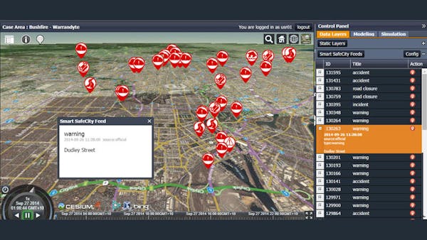
IDDSS collects, manages, analyses, distributes, and visualizes spatial data in real time for enhanced situation awareness. It has been adopted and used for various ongoing research projects in CDMPS and CSDILA with a series of supports from wider industries. The research team has closely followed the Cesium community in the past few years and used Cesium (from version beta 17 to 1.48) as the core visualization engine for IDDSS. The current capabilities include
- Synchronize and visualize live feeds (keywords based) from multiple sources such as social media (Twitter), official emergency channels and crowdsource platforms (e.g., Ushahidi, Warnwave).
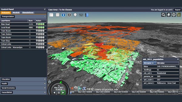
- Integrate and visualize spatial datasets using OGC standards.
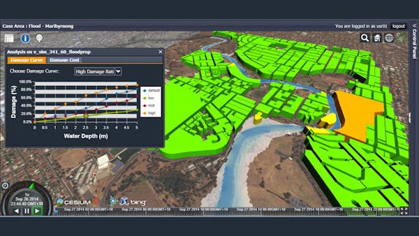
- Flood simulation and regional scale damage assessment.
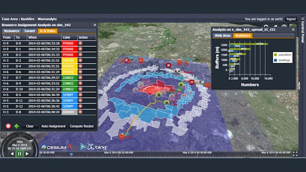
- Bushfire simulation and risk area analysis.
- Regional scale evacuation planning and scenario testing.
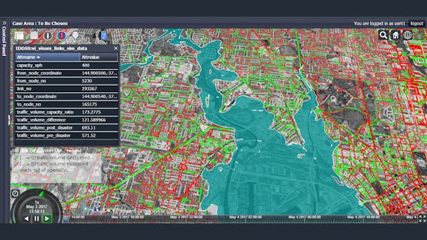
- Critical road network link analysis.
- Local and regional traffic impact assessment during extreme disaster scenarios.
- Historical incident surge analysis: where and when the surge came from and how the rescue resources were dispatched to respond.
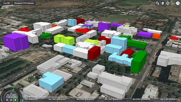
- Real-time building energy consumption monitoring in campuses of The University of Melbourne.
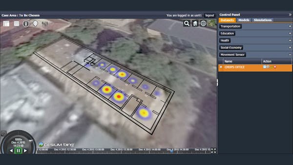
- Real-time indoor movement detection.
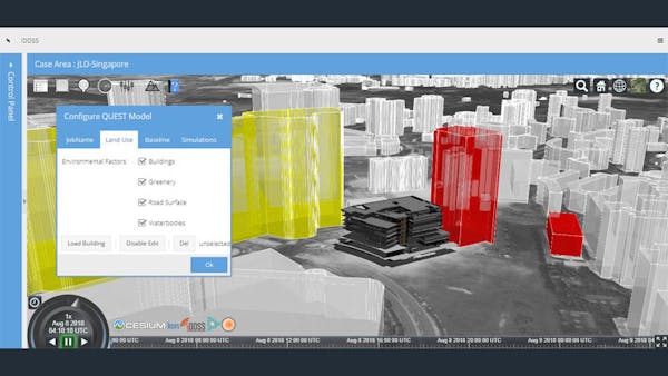
- Edit urban settings in 3D scene, with IFC BIM model represented in 3DTiles.
- Walkability analysis using agent-based modeling with road usage heat map.
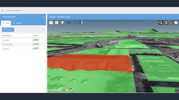
- LADM (Land Administration Domain Model) viewer for visualizing and querying land parcels, boundaries, and survey points, which uses Cesium ion to host and parse their own DEM data as a terrain model in Cesium.