Build 3D geospatial tools to manage and analyze regional or global air traffic. Cesium's WGS84 globe is a precise, accurate foundation for trustworthy visualization and decision-making, and CesiumJS enables you to rapidly add analytics to web apps.

With roots in aerospace, the Cesium platform enables precise flight visualization and analytics that use real-world, time-dynamic data, and it provides a smooth, fast 3D experience in a web browser or in a game engine. Whether visualizing weather and traffic to determine a flight path, training pilots, analyzing actual flight data, or building a flight simulator, Cesium is the accurate foundation for your solution.

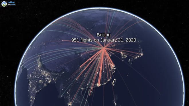
ActiveFlight was developed by the William J. Hughes Technical Center at the Federal Aviation Administration and shows current, historical, or simulated flight paths along with present or historical weather.
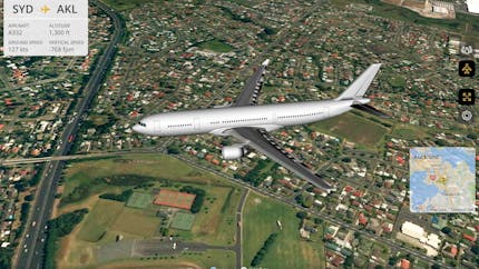
Flightradar24 is the premier flight tracking service, offering a wealth of data for plane enthusiasts watching the skies above them, for news outlets tracking air traffic incidents, and for ordinary people following the flights of friends and family.
.jpg?auto=compress%2Cformat&fit=crop&ar=1.7777777777777777&crop=faces%2Ccenter&w=430)
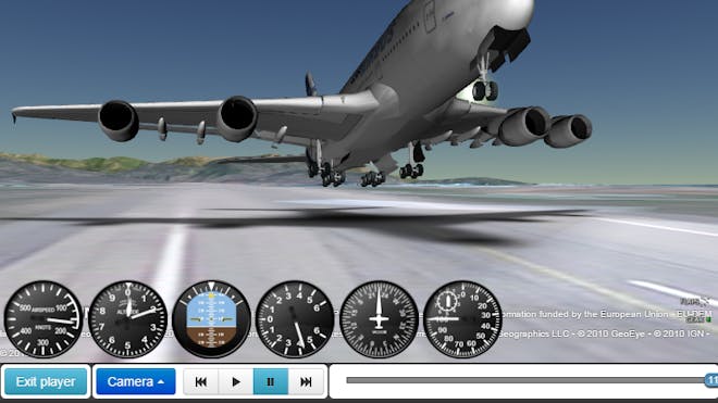
GeoFS is a free-to-play multiplayer flight simulator. Because it's built with CesiumJS, it can run in a web browser and on mobile devices.
Build 3D geospatial tools to manage and analyze regional or global air traffic. Cesium's WGS84 globe is a precise, accurate foundation for trustworthy visualization and decision-making, and CesiumJS enables you to rapidly add analytics to web apps.

Visualize actual flight paths by combining flight logs with Cesium 3D global terrain, imagery, and buildings streamed from Cesium ion. With CesiumJS, build web-based apps for any device.
Build a flight simulator for the web, or use Cesium for Unreal to take advantage of UE's physics and immersive experience.