Cesium Ecosystem Grant Update
Virtual,
Webinar update on Cesium Ecosystem Grants, our $1M program to advance an open and interoperable 3D geospatial ecosystem.
Slides, videos, and recordings of Cesium team presentations and panel discussions
Webinar update on Cesium Ecosystem Grants, our $1M program to advance an open and interoperable 3D geospatial ecosystem.
Speakers: Patrick Cozzi, Cesium; Guido Quaroni, Adobe; Henrik Edström, Autodesk; Eric Haines, NVIDIA; Marc Petit, Epic Games; Alexey Medvedev, Facebook
The Metaverse Standards Forum 3D Asset Interoperability Domain Group is enabling cooperation between the USD and glTF communities to build synergies and reduce overlaps, gaps, fragmentation, and industry confusion. Developers building tools and platforms with USD and integrating the popular glTF standard will share the state of these 3D initiatives and how they can benefit each other. The group explores expanding the scope of 3D asset definitions to include behaviors, sound, physics, and scene composition and discuss how different standards organizations, open source projects, and commercial companies are converging towards a shared material representation for the open metaverse.
Part of NVIDIA OpenUSD Day, Sean Lilley, Staff 3D Software Developer and Lead for Cesium for Omniverse, led this exploration of OpenUSD, 3D Tiles, and geospatial data to create rich digital twins. He offered insight into data pipelines, 3D Tiles streaming, scene management and performance considerations, and the future of USD and geospatial.
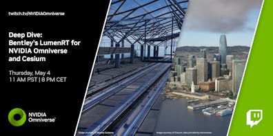
Recorded webinar on the power of Bentley's LumenRT for NVIDIA Omniverse and its integration with Cesium. The panel will discuss how the integration of these tools to build digital twins can help visualize complex construction projects in real-time, optimize project timelines and budgets, and how Bentley and Cesium are driving innovation in the construction industry.
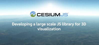
Cesium presented,"Developing a Large Scale JS Library for 3D Visualization" alongside Ted Agolii of Certara; Otoloye Oyeniran of Wajusoft; and Jevelson Simenthy of Comcast.
Cesium's Sean Lilley joined Tam Belayneh, Esri; Michael Beale, Autodesk; and Leonard Daly of The Khronos Group to discuss how to use glTF for large 3D models, terrain, scanned imagery, and connect it to GIS; Architecture Engineering, and Construction (AEC); and Building Information Model (BIM) meta-data to the individual nuts-and-bolts. glTF’s Geospatial Special Interest Group explained the limitations of today’s glTF and presented their solutions to extend it for the Geospatial and AEC industries. Hierarchical Level of Detail (HLOD), point clouds, geometry and texture compression, and meta-data solutions for the urban digital twin and how it applies to the Metaverse were additional topics discussed.
Cesium is building an integration into O3DE to stream and render massive high-resolution 3D content and full-scale 3D globes, allowing developers to build immersive real-world applications using O3DE such as flight simulators, real-world first-person training, AEC applications, digital twins, and more.
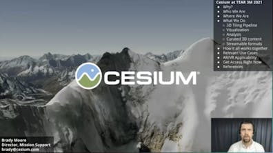
Cesium's Brady Moore joined experts from the geospatial data world—including representatives from Esri, Maxar, and blackshark.ai— to share experiences of development with Unreal Engine. Among the topics discussed are the wide range of use cases for representing worlds digitally, recent changes to the geospatial world, and ways that the ingredients these companies bring to the table can be amalgamated into different recipes to solve the various challenges that end users face.
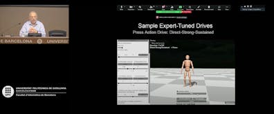
While many CG research groups are producing animated crowds of thousands of people, generally the agents are mostly pedestrians wandering the traversable areas. Dr. Badler's recent work addresses the impact of personality type on individual movements, considers environmental influences on locomotion and group behaviors, attempts to characterize and reanimate large-scale audiences, and investigates workflows to visualize and repopulate ancient societies.
This course is an introduction to the concepts of the metaverse, organized by Patrick Cozzi and Marc Petit. In the afternoon session, Morgan McGuire, Jeff Petersen, Nadine Alameh, and Neil Trevett covered themes of openness, interoperability, and scale.
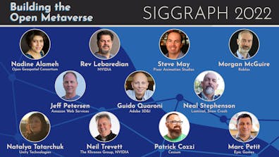
This course is an introduction to the concepts of the metaverse, organized by Patrick Cozzi and Marc Petit. In the morning session, Neal Stephenson, Guido Quaroni, Steve May, Natalya Tatarchuk, and Rev Lebaredian spoke about the origins, current state, and potential future development of the open metaverse, including 3D-first computing, game engine ecosystems, the evolution of content creation, and scaling users and worlds.
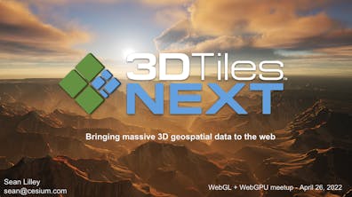
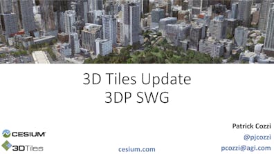
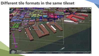
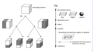
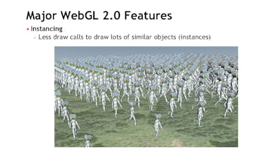
3D Tiles Next is the result of Cesium-led collaboration across the community, government, and industry to evolve the 3D Tiles standard to support game-like interactivity over massive 3D geospatial datasets.

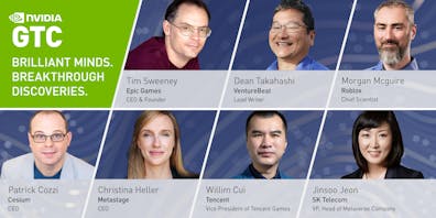
Cesium CEO Patrick Cozzi joined a panel of global Metaverse futurists for "A Vision of the Metaverse" at NVIDIA GTC 2021. Experts shared their vision of the Metaverse, its potential, and what needs to happen to build the foundation. The event featured:
Dean Takahashi, Lead Writer, GamesBeat/VentureBeat
Tim Sweeney, Founder and CEO, Epic Games
Morgan McGuire, Chief Scientist, Roblox
Rev Lebaredian, VP of Simulation Technology and Omniverse Engineering, NVIDIA
Patrick Cozzi, CEO, Cesium
Willim Cui, Vice President of Tencent Games, Tencent
Christina Heller, CEO, Metastage
Jinsoo Jeon, VP, Head of Metaverse Company, SK Telecom
Cesium's Shehzan Mohammed and Bao Tran presented "Bridging the Physical and Digital Worlds: Cesium and 3D Tiles for O3DE" at this conference by the Linux Foundation that explores open source collaboration in gaming.
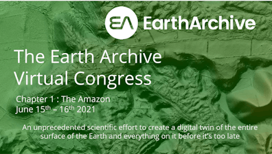
Cesium CEO Patrick Cozzi joins experts from Esri, Trimble and Intel Geospatial for the Geospatial Infrastructure for Conservation: Technology Panel Discussion. This talk was presented at the Earth Archive Virtual Congress.
Cesium joins experts from Epic Games, Microsoft and NVIDIA to discuss off-the-shelf technologies used to rapidly build and deploy a streaming interactive simulation application using the Cesium for Unreal plugin, OGC 3D-Tiles, Unreal Engine, and Holographic Remoting from Azure to the Microsoft HoloLens 2 device.

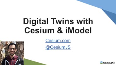
Cesium joins Ray Bentley, Executive VP, Bentley Systems to present Digital Twins with Cesium & iModels (Using Tiles to Improve Display Performance for Massive Data Sets) at The iTwin Developer Conference. The event brings infrastructure thought leaders together to discuss digital twin technologies and the vision of an open ecosystem for infrastructure digital twins.
Cesium helps the James Martin Center for Nonproliferation Studies ("CNS") gain more insights from their 3D data through visualization and analysis, and make those insights easier to share with journalists, policymakers, and the public.

The latest news for CesiumJS. To see a video of the presentation, see the full session recording.
Automate data integration using 3D Tiles. To see a video of the presentation, see the full session recording.
Using Cesium geometry in browser based apps. To see a video of the presentation, see the full session recording.
A presentation about 3D formats with Esri products, including I3S and 3D Tiles. To see a video of the presentation, see the full session recording.
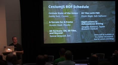
Yearly Cesium update at SIGGRAPH, emceed by Patrick Cozzi and including presentations from the Cesium team, Mozilla, Esri, Safe Software, and Toyota Research Institute. Individual slides available below.
Cesium State of the Union. Gabby Getz, Cesium
A-Terrain for A-Frame. Anselm Hook, Mozilla
3D Formats: I3S, 3D Tiles, and Beyond. Tamrat Belayneh, Esri
3D Tiles with FME. Dmitri Bagh, Safe Software
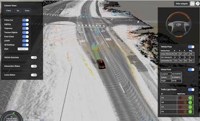
Applications in Autonomous Driving. Vangelis Kokkevis, Toyota Research Institute


Kicking off the yearly Cesium update at SIGGRAPH, followed by:
Publishing Reality Meshes to Web from Bentley ContextCapture using Cesium 3D Tiles. Makai Smith, Bentley
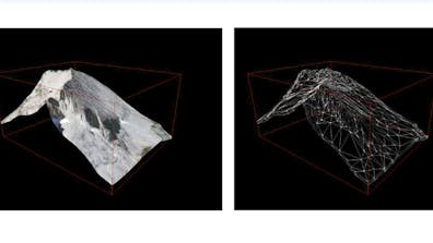
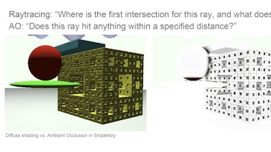
Baking AO in the glTF Pipeline. Gary Li, Cesium
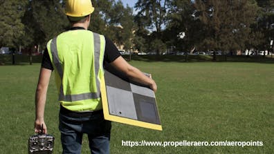
Making Drone Data Useful in Cesium. Chris Cooper, Propeller
3D Tiles and OGC's 3D Portrayal service standard. Ralf Gutbell, Fraunhofer
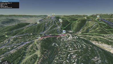
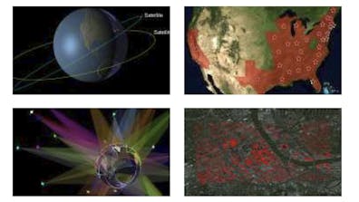
Visualizing Geostationary Satellite Orbits in Cesium. Ed Mackey, Analytical Graphics, Inc.


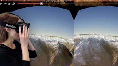
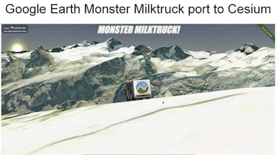
Advice based on porting several projects from Google Earth to Cesium. One of the projects, the Hiroshima Archive, also won The Best Cutting Edged Map prize at FOSS4G 2015.
Yearly Cesium update at SIGGRAPH, including presentations from AGI, NICTA, and mousebird consulting.
Cesium State of the Union, Matthew Amato, AGI
Community Demos, Hannah Pinkos, AGI
Using Cesium Terrain in a Native Mobile Toolkit, Steve Gifford, Mousebird Consulting
Cesium at NICTA, Kevin Ring, NICTA
3D Tiles, Patrick Cozzi, AGI

Yearly Cesium update at SIGGRAPH, including presentations from AGI, NICTA, and Camptocamp.
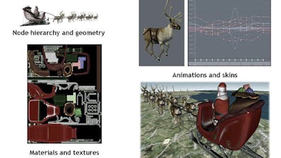
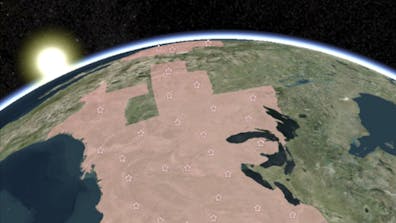
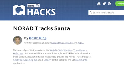
NORAD Tracks Santa, Patrick Cozzi, AGI
Space Situational Awareness, Alex Wood, AGI
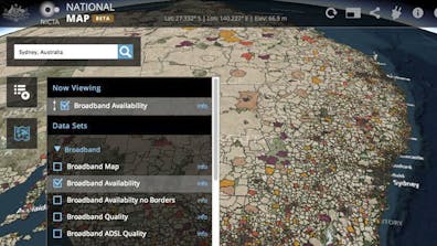
National Map, Keith Grochow, NICTA
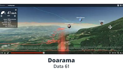
Doarama and cesium-blockworld, Chris Cooper, NICTA
OpenLayers 3 & Cesium Integration, Emmanuel Belo, Camptocamp

Not strictly about Cesium, but about virtual globes in general. Written by two Cesium contributors, Patrick Cozzi and Kevin Ring. They also taught a COM.Geo course based on the book.