SAF-Foresight Improves Live Fire Range Safety with CesiumJS
The traditional method for laying out military Range Danger Area (RDA) templates involves hand-drawing traces on clear plastic over a paper map and manually submitting them for approval—they can take hours to create, must be physically delivered across stakeholders, and are prone to version-control errors. SAF-Foresight brings 3D digitization to this process, with multiple ranges overlaid on geospecific training areas in CesiumJS, cutting the time down to mere minutes, enabling singular authoritative version control, and increasing plan access to authorized app users.
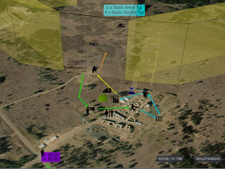
The app’s comprehensive ammunition library and accurate location data are vital to range planning. Courtesy SimCentric Technologies.
SimCentric Technologies’ SAF-Foresight is a server-based app for planning and safety for military live fire exercises, rapidly developing, visualizing, and adjusting live fire spatial parameters in 3D. The app includes interactive planning components, markup capabilities, activity locations, automated safety analytics, target placement analysis tools, appointments, and Notifications to Airmen (NOTAMs) in this real-time common operating picture (COP).
.png?auto=compress%2Cformat&w=870)
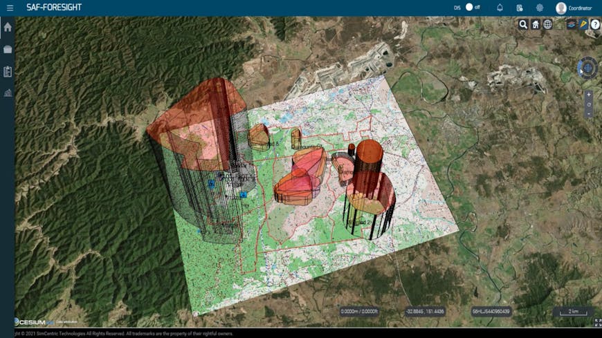
SAF-Foresight provides real-time 3D COPs for military live fire exercises. Courtesy SimCentric Technologies.
Not only does SAF-Foresight enable the most efficient use of training times and locations, but it also takes into account the risk profiles that can occur in live fire exercises. Real-time analytics indicating fratricide risk are modeled with alerts to key stakeholders, enabling mitigation before a catastrophic event occurs. SAF-Foresight shows if configurations are compliant or noncompliant, allowing planners to optimize their range activities and balance the competing demands of realism, concurrency of use, and safety deconfliction. Specific roles and modular tiered permissions are assigned in the app, such as coordinator, planner, and range control officer, to align with safety protocols and ensure stakeholders act within the limits of their authority. Everything in SAF-Foresight’s COP is permission controlled.
Coordinators use SAF-Foresight for efficiency in planning training times and locations and to reduce risk among soldiers. Courtesy SimCentric Technologies.
Initially developed in 2017, SAF-Foresight has been approved for use on Australia’s Defence Protected Network; other countries are in various stages of trial, test, and acquisition. The app can be customized for national doctrine variances.
SAF-Foresight’s users can access Bing Maps Aerial imagery and Cesium World Terrain in Cesium ion and stream those datasets into CesiumJS for real-world context and details pertinent to the training events, including implications for live fire RDA templates. Cesium ion assets are coupled with GeoTIFFs from defense organizations in SAF-Foresight; the app can also use ASCII files to provide a high-fidelity 3D terrain profile. Safety distances, ricochet distances, and other similar information is stored in SAF-Foresight’s ammunition template library as a CSV file—users can add and update their own ammunition tables.
Because considerations for range safety include distances, angles, and heights, visualizing the training areas in 3D is vital for modern planners and the soldiers taking part in the training events, especially for managing terrain profiles and air movement corridors. SAF-Foresight’s 3D geospatial representation provides the full picture with intervisibility among aggregated live fire exercises across multiple doctrine types.
Cesium ion assets are coupled with GeoTIFFs or ASCII files from defense organizations in SAF-Foresight. Courtesy SimCentric Technologies.
SAF-Foresight’s standards-based architecture enables doctrinally accurate RDAs to be scheduled, assigned to areas, and exported to relevant third-party systems for rehearsal and virtual walk-throughs in synthetic training environments.
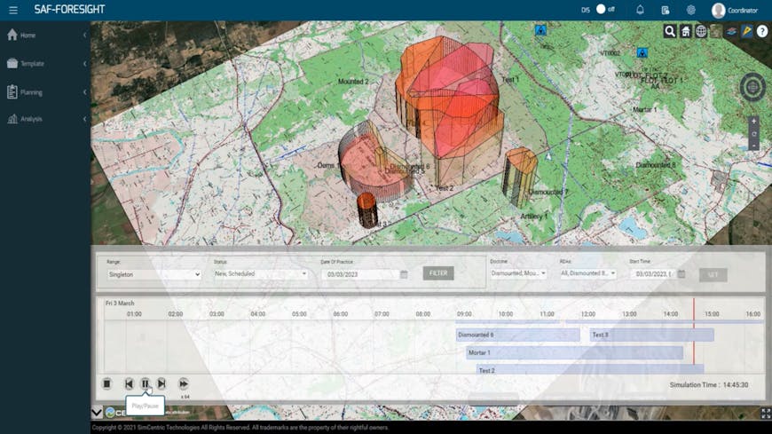
RDAs created in SAF-Foresight can be scheduled, assigned, and exported. Courtesy SimCentric Technologies.
With Cesium ion and CesiumJS, organizations can pair their data with Cesium’s assets for geospatial context—and share it broadly or limit access for protected systems. Sign up for your own Cesium ion account.