Institute for Photogrammetry Enhances Research with Cesium
Established more than 50 years ago, the University of Stuttgart’s Institute for Photogrammetry focuses on photogrammetry, remote sensing, geoinformatics, and computer vision. IFP uses Cesium frequently as it presents data to other professionals, shares supplemental academic information, and bolsters student learning.
Data is being collected and shared faster and more easily than ever—satellites of all sizes orbit our planet, and even our phones come equipped with lidar scanners. With access to this immense amount of data comes the ability to make critical decisions by using and analyzing it. It is IFP’s mission to make sense of this data and provide it to experts across fields.
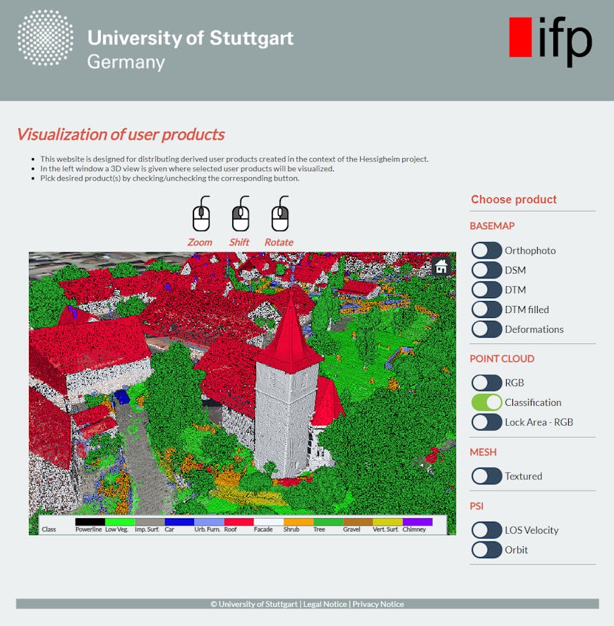
IFP visualizes a large point cloud captured by a drone. This data is publicly available as a classification benchmark. Courtesy IFP.
The researchers at IFP spend their days working with complex 4D data, including point clouds and meshes with attributes that can’t be analyzed in static images. Often the datasets are very large and vary in formats—and customers, decision-makers, and the public can’t be expected to have and know how to use the specialized tools IFP employs. Instead, IFP uploads massive, disparate datasets to Cesium ion, where they are stored and optimized as 3D Tiles. Then IFP streams the 3D Tiles in CesiumJS, which the institute uses to create web portals for stakeholders to access and explore the data. Researchers know the data is properly located on a WGS84 globe, and stakeholders can view it in a browser on any device.
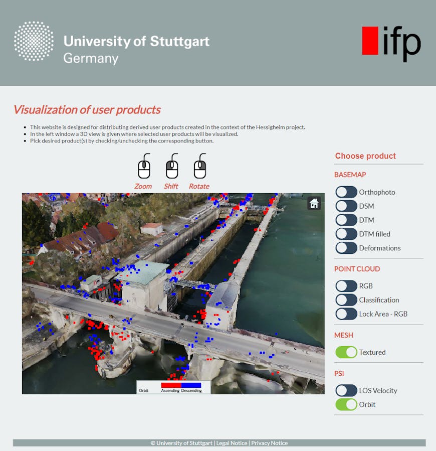
IFP presents this persistent scatterer, derived from synthetic aperture radar data, on 3D city models to experts and decision-makers for risk assignment. Courtesy IFP.
Because the Cesium visualizations are interactive and shareable, IFP researchers can direct readers to them as supplements for figures presented in their academic papers as well.
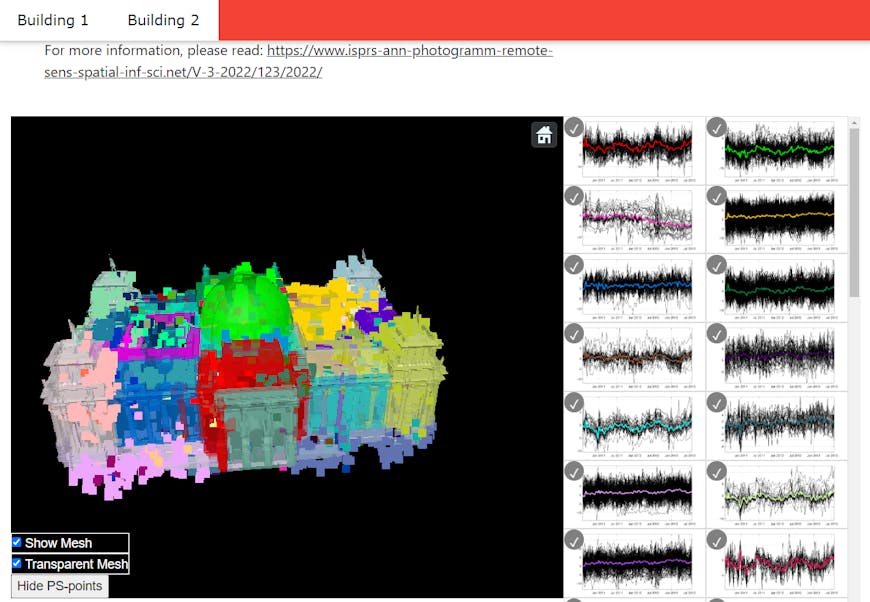
Groups of persistent scatterers from SAR interferometry, linked to structural building elements, along with their deformation time series. Courtesy IFP.
In IFP’s Master of Science in Geomatics Engineering program, students learn to use Cesium and other tools to visualize spatial data. The SLAM Integrated Mobile Platform, for example, integrates a laser scanner, GNSS antenna, and remote-controlled vehicle to perform simultaneous localization and mapping (SLAM) and georeference the results. (Our readers can try out IFP students’ SIMP Viewer and take a look at the documentation on GitHub.) Using Cesium in their studies enables students to learn 3D geospatial data visualization in a hands-on way and be prepared for working with massive heterogeneous datasets in their future endeavors.

The SIMP Viewer is entirely student-built. Courtesy IFP.
Are you incorporating Cesium in your lessons or research? Try Cesium ion with a free account.