Beirut Data Available for Government Users
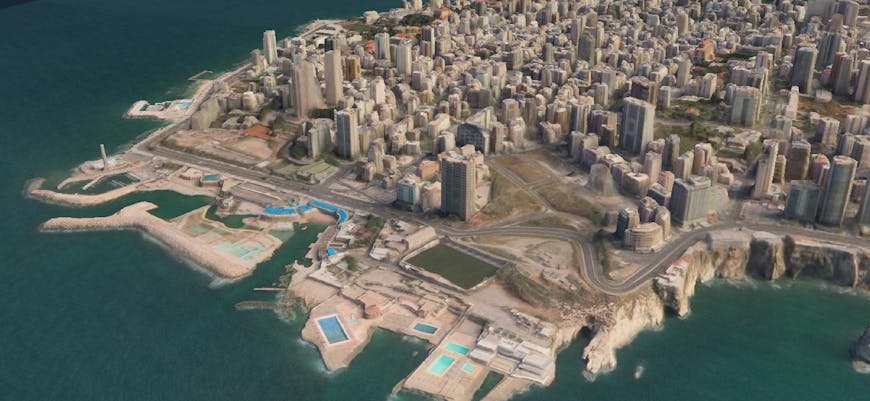
A highly accurate 3D surface model of Beirut is now available for free to all US federal government workers. The 3D data was captured before Lebanon’s capital city suffered a massive explosive event on August 4, 2020.
The new 3D dataset is being offered in addition to 3D surface models of other global cities made available through a joint intiative between Cesium and Vricon, a Maxar company, to help federal employees work more effectively from home.
Thanks to 3D Tiles, users can easily stream and share the 3D datasets to any device, almost anywhere in the world.
The epicenter of the recent explosion in Beirut as measured by USGS.
The Beirut 3D surface model includes 54 square miles of 3D TIN models with an absolute accuracy of 3m SE90 and 50cm resolution.
If you’d like access to these resources and have a valid .gov or .mil email address, follow these steps.
If you’re interested in learning more about how Cesium supports the federal government, reach out. I’d love to hear from you.