Simulation, Planning, and Visualization for City Development with Smart City Explorer Web Platform
Siradel produces 3D digital twins of cities. The data-driven platform has simulation capabilities for smarter infrastructure network planning and greater well-being of inhabitants.
A subsidiary of the Engie group, which has offices in more than 60 countries, Siradel works with telecom operators and with national and local authorities to make cities more sustainable, resilient, and safe.
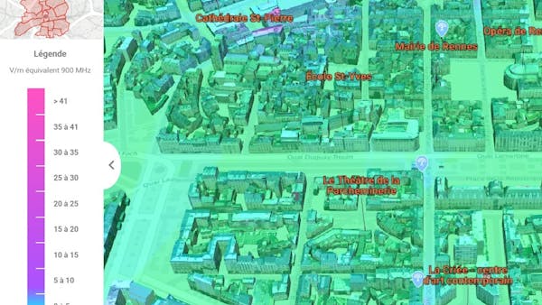
Mapping electromagnetic fields in Rennes
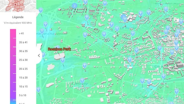
In this use case, Siradel simulated the impact of urban infrastructure for Rennes, France. Using the Smart City Explorer platform, Siradel examined the electromagnetic fields (EMF) related to mobile networks and mapped EMF exposure levels throughout the territory on a globe built with Cesium.
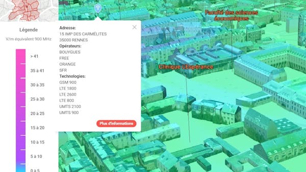
The resulting 3D scene is displayed on a public website customized by Siradel’s teams that can be consulted by all actors in the city, including representatives, operators, associations, and citizens.
Visualizing radio propagation with Cesium
To build the model, Siradel first took an exhaustive inventory of the city’s relay antennas, then measured the peak levels of exposure in the streets for all mobile networks. Using their Volcano radio propagation modeling software, they also simulated the level of exposure to EMF on the ground, walls, and roofs of buildings in 3D for the whole city.
Visualization in Cesium made Siradel’s simulation and planning tools accessible, creating a smart city platform to aid the development of Rennes.