Virtually Hiking Antelope Canyon with Cesium World Terrain
My mom is an avid hiker. She’s covered much of the American Southwest and recently got back from a trip to Antelope Canyon. It was a trip she’d been planning for ages, and she made reservations months in advance. It’s obvious why the area is so popular. Antelope Canyon is a stunningly beautiful slot canyon on Navajo land in Arizona.
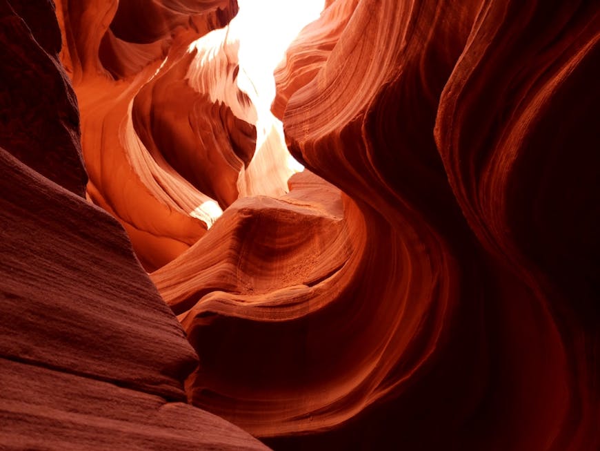
Antelope Canyon, photo courtesy Tina Cutler.
She visited a number of other formations as part of the trip, and as she showed me her photos we checked out the terrain with Cesium so I could get a better idea of what she was showing me and where she’d been.
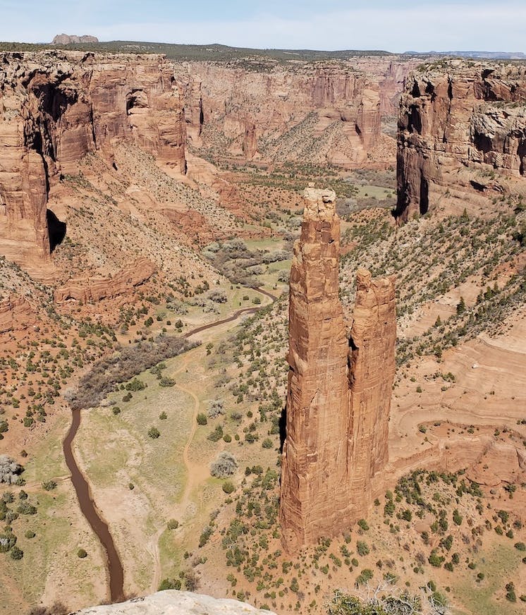
Spider Rock, Canyon de Chelley, photo courtesy Tina Cutler.
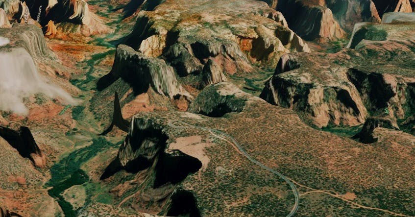
Spider Rock visualized in Cesium, here shown in shadow.
Given that we were reliving her hikes, it was fantastic to see the actual terrain she’d covered and fun to try to recapture her vantage point. We couldn’t have had the same experience without the Cesium World Terrain data, which in this area is 10 m resolution.
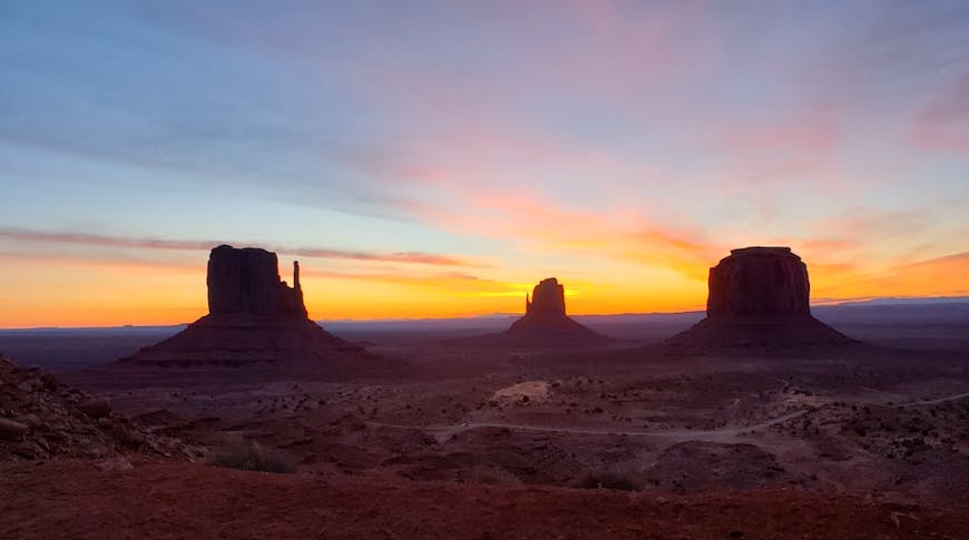
Mitten Buttes, Monument Valley, photo courtesy Tina Cutler. Can you see the mitten shape of each “hand,” with a thumb sticking out?
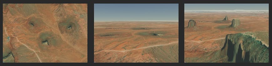
Mitten Buttes visualized in Cesium. On the left, satellite imagery from above, as you’d find in many mapping applications. Center, 3D view without Cesium World Terrain. Right, the mittens come in full focus with Cesium World Terrain.
We’re hardly the first people to relive a hike with Cesium. A number of apps plot GPS tracks on a Cesium globe. RikiTraki allows users to upload their GPS tracks and photos for easing sharing, like this hike of Los Terrones, Cordoba, Argentina.
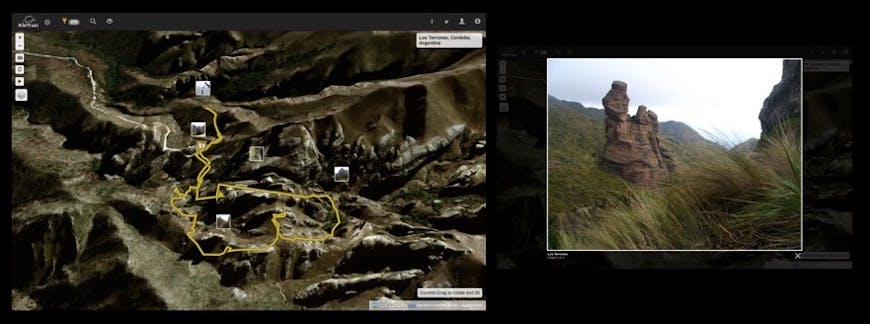
RikiTraki shows uses’ GPS tracks (left) and geo-tagged photos (right) on a Cesium globe.
peakery is a hiking and climbing guide to the world’s mountains. With more than 600,000 peaks, peakery’s 3D maps allow users to scout out peaks to climb based on their experience and to record their trips.
peakery.
And the Red Bull X-Alps 2019 just used CesiumJS to track contestants live in their paragliding and hiking race through the Alps.
Whether you’re into the actual or virtual outdoors, Cesium can give you a clearer perspective of the world around you and a way to share your adventures.