Analyze and Visualize Defense, and Intelligence Systems with AGI's Analytical Services
Systems Toolkit (STK), created by Analytical Graphics, Inc. (AGI), is used to model complex systems for aerospace and defense applications. AGI’s Analytical Services uses STK Components to provide accurate time and coordinate representation as well as advanced analysis features such as route planning, visibility between objects, and communication and navigation analyses. Analytical Services provides an analytical back-end to any web-aware application, allowing for advanced analysis with simple web service calls. All of these apps demonstrate how to produce output in Cesium, bringing analysis to 3D visualization.
Analytical Services currently offers apps in the following areas. These demonstrate some of the functionality in Analytical Services.
Airspace Services
The Unmanned Traffic Management (UTM) application provides UAV operators and planners an application that allows them to plan flights (both local and beyond visual line-of-sight) and monitor them in real-time. The Analytical Services provide REST interfaces that the UTM employs to assess planned or real-time flight routes for navigation errors, terrain intersections, and FAA airspace incursions.
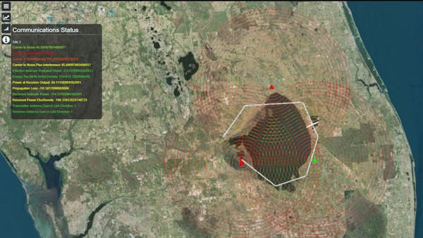
Communication Services
The Communication System Link Budget service allows users to set up a transmitter, receiver, and any number of interference sources (jammers), each along any supported path, and receive link budget information for the receiver by time. This can help you understand where communication links are weaker and stronger.
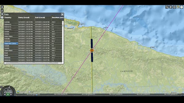
Satellite Pass and Overflight Services
With the Satellite Pass app, users can see details about satellites’ locations. They can view a satellite’s orbit over time, view a list of countries a satellite flies over, with entry and exit times, see when select satellites are within view, and see the pass visualized in Cesium. This demonstration application shows how you might use the Analytical Services Satellite Passes and Overflight web service calls.
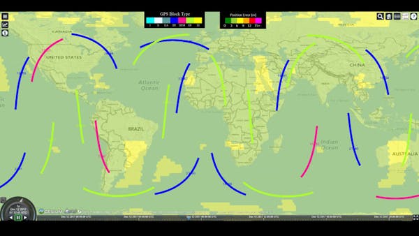
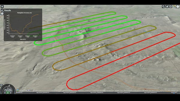
GPS Services
The GPS Services app performs navigation accuracy calculations over a wide-range of options, including sites, routes, and search patterns. Users can view today’s maximum navigation accuracy over the entire world, view today’s current navigation accuracy using an animated heat map, and view all current GPS satellites, including their block type and current health status.