It's Scary What You Can Build with Cesium
What are you doing with Cesium this Halloween? Our community of developers has taken Cesium places we never could have guessed, from extreme sporting events to city planning to outer space. Here we look at a few of the spookiest.
Pilatus Railway
If you have a fear of heights, be cautious when using Cesium’s 3D maps. Since Cesium developers can bring their terrain data into 3D focus, heights stand out in a way they never can on a 2D map. For example, with the train simulator Geoglyph Rail, viewers can take train rides all over the world, including up the Pilatus Railway, the steepest cogwheel train track on earth. The line opened in 1889 and still uses the original rack rails laid on solid rock, which are over 100 years old. After so many years of use the rails have worn down, but it was discovered that they could be turned over to provide a new wearing surface for the next century.
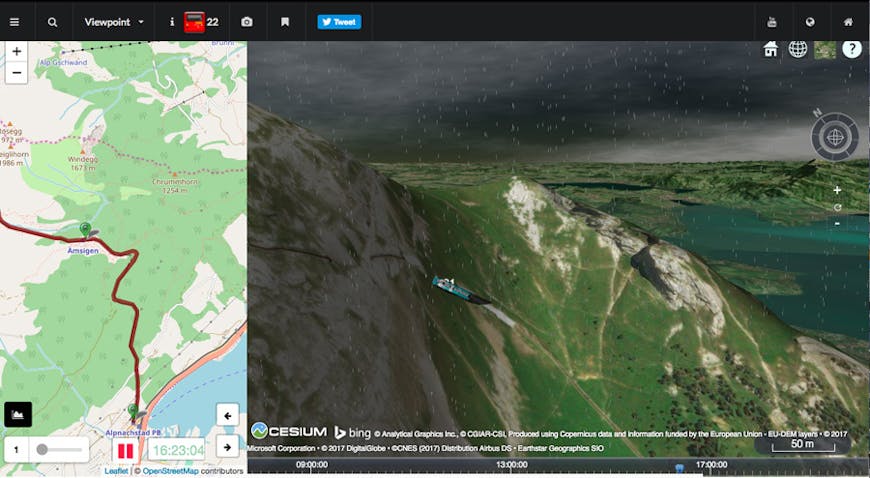
Pilatus Railway. Image source: Geoglyph Rail.
Great Blue Hole
Some have a fear of heights, but what about depths? Take the Great Blue Hole, a massive underwater sinkhole off the coast of Belize. The circular-shaped hole, which lies near the center of the Lighthouse Reef, is approximately 1,043 ft across and 407 ft deep. Many researchers believe the submarine sinkhole was formed during the last glacial period as a limestone cave. The sea levels were much lower at that time, so as the water began to rise the cave flooded and the roof collapsed, leaving the inner portion intact. While to some experienced divers, this is a bucket list dive, to many other visitors, it’s the thing nightmares are made of.
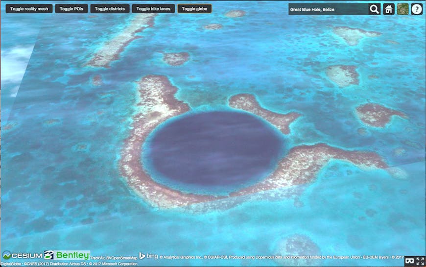
Great Blue Hole. Image source: Bentley’s ContextCapture Orlando demo.
Chillon Castle
Does history give you chills? Cesium makes time travel possible. Not only can you control the timeline to see the same area over time, but Cesium developers have brought all sorts of historical sites to life. For example, smapshot is an archival project that geolocalizes historic photos, allowing you to see them in the locations they were taken. One of these photos is of Château de Chillon. What you can’t see in this beautiful photo and serene setting are the dungeons that make the castle famous. Immortalized by Lord Byron’s “The Prisoner of Chillon,” the dungeons held numerous religious prisoners and witches, and to this day are reportedly haunted.
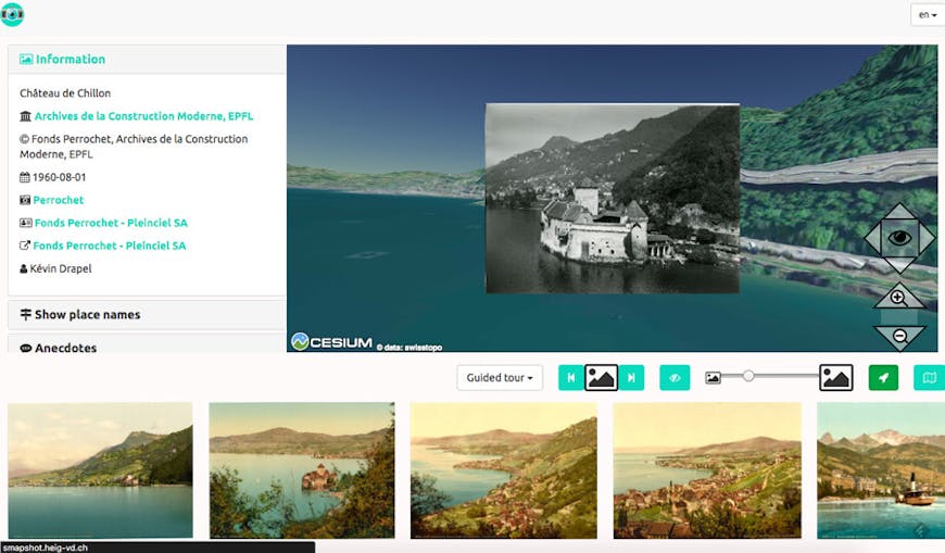
Château de Chillon. Image source: smapshot.
Darvaza Crater
Cesium maps allow you to explore all sorts of spooky places from the safety of your own device. Take the fiery Darvaza Crater, known by locals as “The Door to Hell”. The gas crater has been on fire for more than 40 years in the middle of the Karakum Desert of central Turkmenistan. In 1971, the site gained the attention of a group of Soviet geologists and engineers who were searching for oil fields. They set up a drilling rig and operations but quickly found that they were drilling on top of an unstable pocket of natural gas. When the rig and camp collapsed into a crater and was buried, there were concerns that dangerous releases of poisonous gases were imminent. The engineers thought it best to burn the gas off, estimating that the gas would burn off within a few weeks. Instead, it continues to burn to this day.
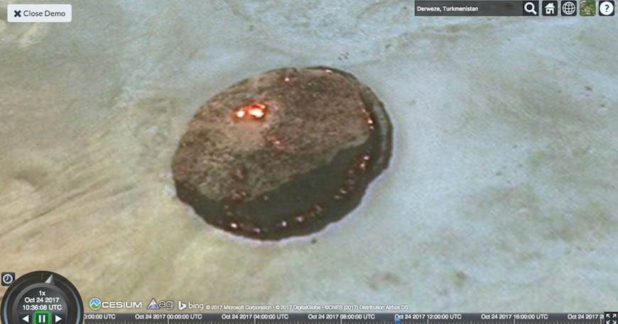
Darvaza Crater, which has been burning since 1971.
This image was taken from the simple Cesium demo on our home page. Working in Cesium isn’t scary! Download the library to build your own app.