High-resolution Arctic Terrain with ArcticDEM
ArcticDEM is a project to produce a pan-Arctic Digital Elevation Model at a 2-meter resolution. We’re proud to bring it to Cesium.
The data is a collection of time-dependent DEM strips and a seamless terrain mosaic encompassing all land area north of 60 degrees north latitude. It can be distributed without restriction, thanks to collaboration between the National Geospatial-Intelligence Agency (NGA) and National Science Foundation (NSF). As a response to the need for high-quality terrain data for remote locations, ArcticDEM is not intended as a single edited project; instead it is an expansive collection of time-dependent elevation models and includes the processing infrastructure to add to it via the ever-increasing constellation of satellites.
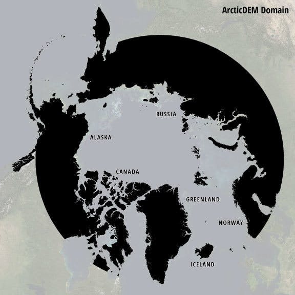
ArcticDEM coverage map[source]
The models begin as stereoscopic imagery of the Arctic collected with DigitalGlobe’s WorldView-1, WorldView-2, and WorldView-3 satellites. This imagery is then processed into 2 meter posting elevation models using an open-source photogrammetry software package from Ohio State University, Surface Extraction with TIN-based Search-space Minimization (SETSM).
Here’s a few views of the Alaskan terrain:
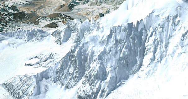
Denali summit in high-detail.
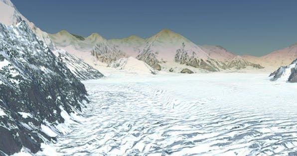
A snow-covered valley near the foot of Denali peak.
Including the ArticDEM dataset is easy. Load with this code:
var viewer = new Cesium.Viewer('cesiumContainer', {
    // Load ArcticDEM terrain
    terrainProvider: new Cesium.CesiumTerrainProvider({
        url: Cesium.IonResource.fromAssetId(3956)
    })
});
Beautiful datasets like this are what allow Cesium to shine. If you have terrain data you’d like to share or photogrammetry models that you would like us to tile, feel free to tweet @CesiumJS.