View Archival Pictures Geolocalized by Volunteers with smapshot
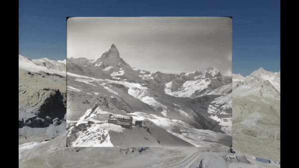
smapshot is a participative time machine of archive photographs. Many historical images stored in archives are forgotten or underused. These photographs contain valuable information about landscape and cityscape variations that occurred during the last 170 years. This information is of interest for many people such as scientists, land planners, and the general public.
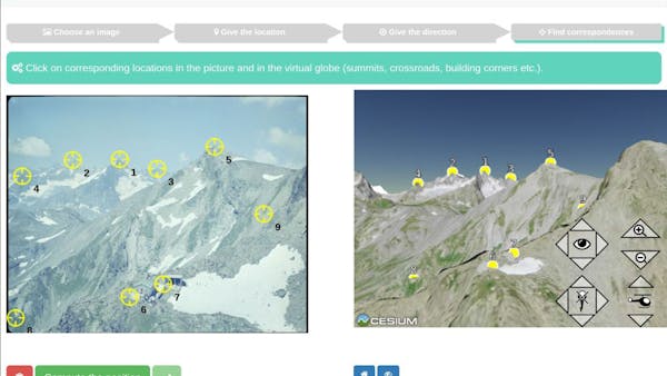
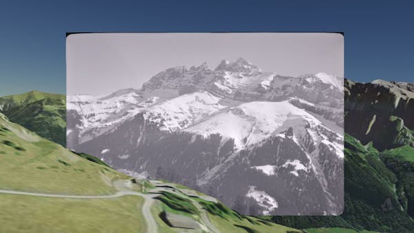
smapshot exploits volunteers’ knowledge to geolocalize the photographs. Once geolocalized, the images are inserted in their spatial context in the virtual globe. Hence the current landscape rendered by Cesium can be compared with the historical landscape recorded in the picture.
The project was developed at the University of Applied Sciences and Arts, Western Switzerland.