Cesium Version 1.26 Released
We are happy to announce the release of Cesium 1.26. Highlights include
- Added support for clustering Billboard, Label and Point entities. #4240
- Added DistanceDisplayConditions to all primitives to determine the range interval from the camera for when it will be visible.
- Fixed a bug where viewing a model with transparent geometry would cause a crash. #4378
For the full list of changes, see the change log.
News
- Cesium made Hacker News!
- Been hearing about 3D Tiles? Read about the background and our plans for 3D Tiles, which the OGC is considering as a Community Standard.
- We have two great students from Penn, Judy Weng and Sumit Shyamsukha, working on 3D Tiles.
- Entwine now generates 3D Tiles for massive point clouds, including 4.7 billion points in NYC.
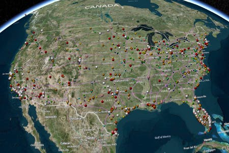
- Orbit Logic is using Cesium for DigitalGlobe Direct Access Facility Collection Planning System.
- virtualcitySYSTEMS’ latest 3DCityDB includes a Cesium web client. See the live demo.
- Ben Lowe has written about how to Fly Through Your Strava Activities, Routes and Segments With Cesium “Earth” View.
- Check out this “Real” air traffic control system + flight simulator.
- Watch OpenSensorHub’s demo of draping drone video on the ground in real time:
Events
- We’ll be tackling as many bugs as possible at this month’s Cesium bug bash. Tell us what bugs you want fixed!
- The LocationTech Tour is coming to Philadelphia Thursday, October 6.
- FedGeoDay will be October 13, 2016, in Washington, D.C.
- Slides are up from Patrick Cozzi’s presentation on 3D Tiles for the OGC community, presented at the 3DIM DWG, Point Cloud DWG, and 3DPS SWG.
- TU Delft organized a 3DViz 2016 workshop on visualization with Cesium and 3DCityDB.
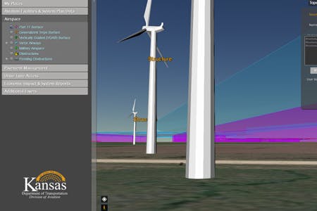
Showcases
We have five new showcases up on our demos page.