CITISENS: A Mobile Application for Reporting Wildfires
The main sources of active “hotspot” location data during a wildfire event are satellite services. Unfortunately, due to the orbital properties of the satellites providing these services, the data are often lacking either in spatial resolution (geostationary satellites) or in temporal resolution (polar satellites).
Over the past few years PhD candidate Nikos Bogdos and his advisor Prof. Elias Manolakos at the University of Athens have been developing innovative wildfire risk assessment tools, such as wildfire behavior simulators, that rely on data available in the public domain to mitigate the catastrophic consequences of wildfires. In this context they also investigated how today’s smartphone-equipped citizens could help tackle one of the most crucial hurdles in effective wildfire management: active wildfire event georeferencing.

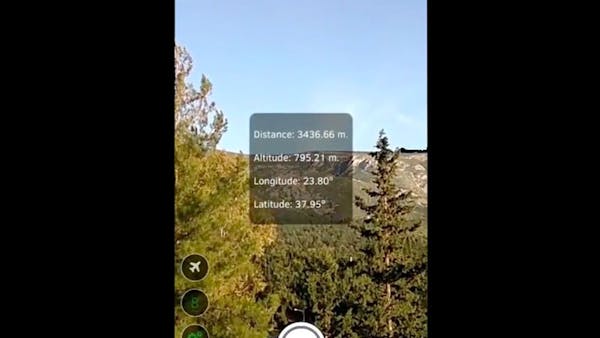
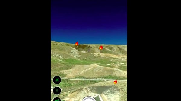
To do so they incorporated the direct georeferencing methods currently implemented by special mapping equipment into a mobile app, CITISENS. The key idea is that citizens can point to a wildfire hotspot using their smartphone’s camera; the app uses the phone’s motion and orientation sensors along with the magnetometer of the device to obtain the geographic coordinates of the intersection point between the device’s view ray and a Digital Elevation Model (DEM) (patent pending). During the reporting process CITISENS obtains the measurements of the device’s sensors and calculates the position of the wildfire using the Cesium terrain. All the calculations take place on the mobile device, thus freeing the remote server from considerable computational load.
Cesium allowed CITISENS to choose from a set of terrain providers, sampling their data at specific locations and at configurable accuracy to balance data accuracy with response time. This flexibility, along with the fact that Cesium is WebGL-based, allowed them to build CITISENS using mobile development frameworks such as Apache Cordova to port it to any OS platform and provide a native user experience. CITISENS is currently under testing from a user acceptance testing (UAT) team.