Visualize Outdoor Activity GPS Tracks with Geolocated Photographs with RikiTraki
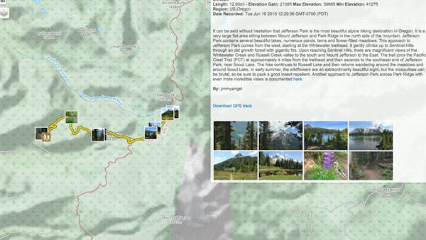
The purpose of RikiTraki is to maintain and share a log of GPS tracks around the world recorded by registered users. The latest version, currently in beta, includes a number of options for users. All recorded tracks are viewable to all users, i.e., there is no need to register to view and share them. The application provides visualization of all trailheads over a map or a globe, and allows for filter, search, and click to drill down to the details of each entry. The details include visualization of the GPS track presented over a selection of base maps, along with a description of the trail and associated metrics such as distance and elevation. An interactive elevation widget is available to visualize the elevation profile. The trail view displays geotagged pictures along the track and has a slideshow capability. Users have the option to visualize the GPS track in a 3D terrain view.
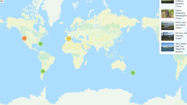
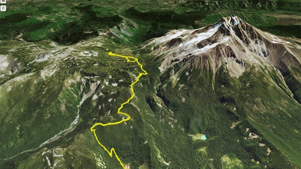
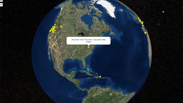
RikiTraki uses Cesium to display all the trailheads over a globe, with the ability to pick and navigate individual tracks. The application also uses Cesium to display a visualization of individual trails over a 3D terrain using the Cesium Terrain Provider.
RikiTraki is entirely written in Javascript, HTML, and CSS, and it is mobile-friendly. In addition to Cesium, RikiTraki uses the Leaflet mapping library for visualization over projected base maps and customizes Cesium with Leaflet-like controls to ensure a consistent interface between the two mapping frameworks. RikiTraki also uses additional open source components such as jQuery and Bootstrap. On the server side, RikiTraki runs on Nodejs and MongoDB, hosted in Openshift.
RikiTraki is updated regularly with new trails and new features. The author maintains and publishes the source code in Github.
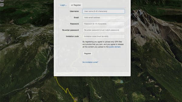
During the beta phase, users need to request an invitation via the registration dialog before signing up.