Explore Mars in 3D with NASA Mars Trek
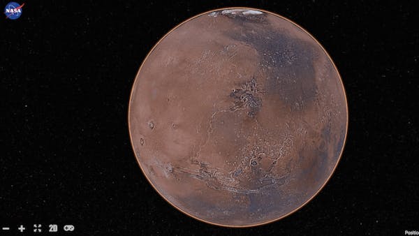
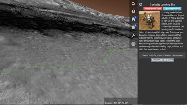
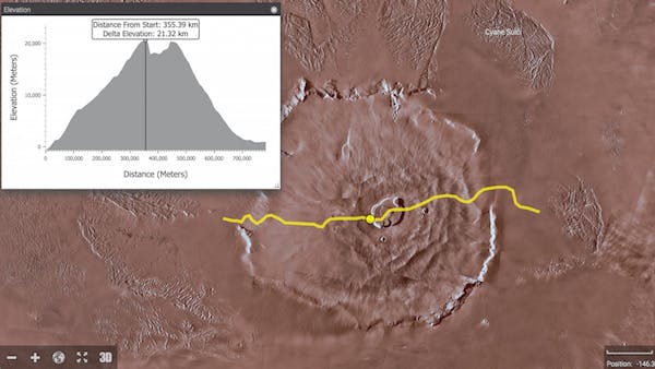
With MarsTrek users can explore the Mars terrain: fly over Olympus Mons, a 70,000 foot mountain; fly through the canyons of Valles Marineris, 2,500 miles long and up to 4 miles deep; follow the paths of the Mars rovers; and explore the locations of future Mars landing sites.
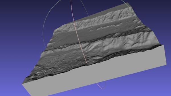
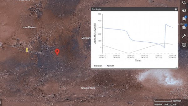
Predefined bookmarks have been added to fly users to various points of interest on the surface. Additional bookmarks will be added as new data sets are loaded. Tools are available to calculate sun angles, to measure surface features including terrain elevations, and to generate STLs that can be sent to a 3D printer.
The software is built using AGI’s Cesium JavaScript Library and Esri’s ArcGIS. We previously built a Lunar data viewer using Adobe Flash. The wide adoption of WebGL, including GPU acceleration, has us porting our applications to this framework. The data servers expose OGC interfaces and are hosted on Amazon’s EC2 network.